Olympic National Park Beaches
Olympic National Park Beaches: Descriptions and photos of the impressive beaches in the Olympic National Park, not too far from Port Angeles WA, with resources like maps and tide table links.

Most of the Pacific Ocean beaches of Washington's Olympic Peninsula are actually a part of the Olympic National Park.
From Shi Shi Beach near the Makah Indian Reservation south to the Kalaloch beaches, this length of shoreline contains some of the most dramatic beaches to be found on the entire west coast.
All of the Washington State Pacific Ocean shoreline north of the Quinault Indian Reservation is included in the Olympic National Park beaches, with the only exceptions being the beaches on native reservations.
Here are all of the Olympic National Park beaches, starting from the north and working our way south.
Shi Shi Beach

Shi Shi Beach is the most northerly of the Olympic National Park beaches, however the Shi Shi Beach trailhead is located in the Makah Indian Reservation near Neah Bay WA. To hike, park or camp on the reservation requires a Makah Recreation Pass, available at several businesses in Neah Bay.
From the parking lot at the trailhead to Shi Shi Beach is an easy 2-mile (3.2 km one way) trail through rain forest. Camping is allowed along this beach, though it can get crowded.
National Park Service: Shi Shi Beach Olympic Wilderness


Port Angeles WA to Shi Shi Beach Trailhead
The Shi Shi Beach trailhead is approximately 6.3 miles southwest of Neah Bay.
Shi Shi Beach is 75.3 miles (121.1 km), or approximately 2.2 hours, west of Port Angeles, WA. If your starting point is not Port Angeles, then:
- Forks is 54 miles away (87 km), a 1.5 hour drive.
- Lake Quinault Lodge is 116 miles (187 km) away, a 2.5 hour drive.
- Hoquiam/Aberdeen: 153.3 miles (251 km) away, a 3.25 hour drive.
- Seattle via Bainbridge Ferry: 157 miles (252.6 km) away, a 4.5 hour transit time.
Olympic National Park Beach near Ozette

The northern reaches of the Olympic National Park beaches offer some of the most inaccessible terrain within the Park's shoreline.
This includes the regions around Ozette and Ozette Lake.
Getting There: From Port Angeles, Lake Ozette is 81.9 miles (132 km) to the west, a drive of approximately 2 hours 38 minutes. From Highway 101 headed west, take Hwy 112 west, and then turn south (left) on Hoko-Ozette Road.
Camping and boating are available around the Lake at the Ozette Ranger Station and campground, and at Swan Bay on Ozette Lake.

Port Angeles to Ozette Triangle Trail Traihead
The trailhead to the Ozette beaches is near the shore of Lake Ozette, which is 75.3 miles (121.1 km), or approximately 1.9 hours west of Port Angeles, WA. If your starting point is not Port Angeles, then...
- Neah Bay is 44 miles (70.8 km) north and west, or an approximately 1.9 hour drive
- Forks WA is 53.6 miles (86.3 km) south, or an approximately 1.25 hour drive
Cape Alava and Sand Point
Three 3-mile (one way) trails from Ozette Lake, one leading to Cape Alava and the other to Sand Point, connect via a 3-mile beach hike, making this a 9 mile round trip hike. This hike is known as the Ozette Triangle Trail.
The trailhead is approximately 30.2 miles southwest of Sekiu on Ozette Lake Road. (At Highway 112, turn south on Hoko-Ozette Road, which turns into Ozette Lake Road.)

Make this a day hike, or camp out on the beach.
On our hike, we encountered clouds of sea birds. Not counting the throngs of seagulls, these included bald eagles, blue herons, harlequin ducks and hooded mergansers (pictured above).
On a subsequent hike of the entire Ozette Triangle Trail, I encountered a black bear sow and two cubs foraging on seaweed. She looked pretty gaunt, and kept a close eye on a throng of hikers keeping their distance.
National Park Service: Visiting Ozette
Olympic National Park Beaches near La Push

The wide and full-flowing Quillayute River separates Rialto Beach from La Push and the Olympic National Park beaches to the south: Second, and Third Beaches.
Port Angeles to La Push, WA
La Push is 68.7 miles (110.6 km) from Port Angeles, less than a 1.5 hour drive. If your starting point is not Port Angeles...
- Forks is 15.4 miles away (24.8 km), or approx. 22 minute drive
- Neah Bay: 62 miles (100 km), or approx. 1 hour 23 minute drive
- Seattle via Bainbridge Ferry: 151 miles (243 km), or approx. 4 hour drive
Rialto Beach

Rialto Beach and the Mora Ranger Station are situated on the north bank of the Quillayute River.
Take Highway 101 to Hwy 110 (La Push Road) heading west. After 6-7 miles, take Mora Road which forks to the right, all the way to Rialto Beach, where you'll find an ample parking lot within a stone's throw of the beach.

Hole-in-the-Wall at Rialto Beach Hike
Hike north up the beach 1.5 miles to the Hole-in-the-Wall, with scenic sea stacks nearby and an excellent spot for tide pools, which are tucked in and around the rocks by the Hole in the Wall. If you make this trek during low tide, the tide pools will give you a treat.
Keep an eye on the tides but also watch for whales, otters and other critters, including Olympic black bears. Absorb the view of sea-stacks, James and Little James Islands, and Gunsight Rock.
Make the outing a day hike, or camp on the beach or in the Mora Campground.
More info:
National Park Service: Mora Brochure
National Park Service: Visiting Rialto Beach
Second Beach
First Beach, and Second and Third Beaches, are located on the south side of the Quillayute River, accessed from Forks or Highway 101 by taking Highway 110 (La Push Road) to La Push. (First Beach is not an Olympic National Park Beach, being a part of the Quileute Nation.)
Second Beach is located south of First Beach, within the Olympic National Park. If you arrive at First Beach, you will have passed the trailheads to both Second and Third Beaches.
Get to the beach via a 0.7 mile moderate hike to the shore from the trailhead at Highway 110 (La Push Road) - well marked.
When you get to Second Beach, you'll find wonderful hard-sand beach to the south. Tide pools (at low tide) are to the north.
National Park Service - Second Beach Trail
TripAdvisor Reviews of Second Beach Trail in Forks WA
Third Beach


Third Beach is yet another sandy crescent accessed by a 1.5-mile easy (though longer than the hike to Second Beach) hiking trail. The Third Beach trailhead is on La Push Road (Hwy 110), close to La Push WA.
Allow time to make the hike to the beach, and time to stroll the beach. Ideally you'll pack some food and stay awhile, because this is a truly magnificent beach.
Camping is permitted on the beach.
National Park Service - Third Beach Trail
Tripadvisor Reviews of Third Beach in La Push WA
Olympic National Park Beaches near Kalaloch

The entire 15-mile stretch of sandy beach from Ruby Beach south to South Beach at the southern point of the Olympic National Park is actually considered to be Kalaloch Beach, with multiple access points.
Several of these access points are unimaginatively named using consecutive numbering, for example, Beach 1, 2, 3, 4.
Port Angeles to Kalaloch Beach, WA
Kalaloch Beach is 91 miles (146.5 km), or about a 1 hour 50 minute drive from Port Angeles, WA. If your starting point is not Port Angeles:
- Forks is 27 miles (43.5 km) north, approx. 40 minutes
- Aberdeen is 80.7 miles (130 km) south, approx. 1.35 hours
- Seattle is 177 miles (285 km) east, approx. 4 hours
All of these Olympic National Park beaches - Ruby Beach, Beach 4, Beach 3, Kalaloch Beach, Beach 2, Beach 1, and South Beach - are easily accessible, expansive, and sandy, with interesting tide pools, wildlife, birdwatching, sea stacks, spectacular sunsets, and, if the weather obliges (and it just might, the whole area being rainforest), storm watching.
Enjoy day use or overnight camping at Kalaloch and South Beach campgrounds, or lodge in style at Kalaloch Lodge.
National Park Service - Tidepool Activities
Ruby Beach

Ruby Beach
Ruby Beach is located on Highway 101 as the highway meets the Pacific Ocean south of the Hoh River.
Ruby Beach is so named for the relatively high concentration of granular garnets in the sand. In the right light, they say, the sand glows pinkish.
Ruby Beach is characterized by some as the most photogenic beach on the Washington shoreline. It's a hard call in my book - from Shi Shi to South Beach, each offers its own magic, but Ruby Beach definitely ranks way up there!
TripAdvisor Reviews of Ruby Beach WA
Ruby Beach is 83.3 miles (134 km), or about a 1 hour 40 minute drive from Port Angeles, WA. But if your starting point is not Port Angeles:
- Forks is 27 miles (43.5 km) east, approx. 33 minutes to Ruby Beach
- Aberdeen is 80.7 miles (130 km) south, approx. 1.5 hours to Ruby Beach
- Seattle is 184 miles (296 km) east, approx. 4 hours to Ruby Beach
Beach 4 and Beach 3

Approximately 4 miles south of Ruby Beach on Highway 101 are the Kalaloch Beach access points known as Beach 4 and Beach 3. The turn-offs for both are well marked.
Beach 4 is known for its excellent tide pools.
There are no facilities at these beaches.


Kalaloch Beach

Kalaloch Beach is roughly 2 miles past the turn-off for Beach 3 on Highway 101 in the southern stretch of Olympic National Park beaches.
As pictured above, smooth sandy beaches, save for the driftwood that litter them, stretch for miles in either direction. "Kalaloch," pronounced KLAY'-lock, means "good place to land" in the local Quinault tongue.
Besides being a spectacular beach for walking, beachcombing, and marine life viewing, Kalaloch Lodge is right there, which is part of Olympic National Park Lodging facilities. Additionally, the Creekside Restaurant serves excellent meals, including lunches to go.
National Park Service - Kalaloch area brochure
Beach 2, Beach 1, South Beach
Beach 2, Beach 1, and South Beach are 1-, 2-, and 3 miles south of Kalaloch Beach, at the southern tip of the Olympic National Park beaches. The hike to each beach is in each case very short, and well-marked at Highway 101.
Strolling or Hiking the Olympic National Park Beaches
Take a hike and take your time. Look up through the lush forest canopy above your head, study the understory of ferns, moss, and various trees; they have a story to tell. Stop and listen, feel the punctuation as the waves crash against the sea stacks and then roll to shore.
Breathe; inhale deeply the perfect mixture of piney-briny air.
Along all the Olympic National Park beaches are numerous opportunities for beach camping, walking, and hiking; with wildlife, bird and whale watching. (Whale migration times are March/April and October.)
Be sure to take a topographic map with you if you plan extensive hikes, as some areas are more easily accessible than others. Some offer passage during high tide, others do not. If you're not careful, it is possible to get caught or stranded by a high tide.
Essential Tools:
Topographic map: This is the one I use. Published by Nat Geo, it's detailed and waterproof.
Local Tide Tables. Several tide resources are linked below.
Check the following websites for good resources with up-to-date information
regarding hiking/camping tips and requirements, wilderness permits, tide charts
and more.
Washington State Tide Tables Easy Calculator
National Park Service: Tidepool Info and Activities
National Park Service: Wilderness Trip Planner
Do You Have a Story and Photos About Any Of
The Olympic National Park Beaches?
The Olympic National Park Beaches?
Someone once said, “There is no place like the beach, where the land meets the sea and the sea meets the sky”... With its ever-changing sights and sounds, the beach can be a place of unexpected, breathtaking, and memorable experiences!
Do you have a beautiful memory, a great story, or an interesting experience that took place at one of the Olympic National Park beaches? We'd love to hear about it! Feel free to share it here in the form below. Be as wordy and as descriptive as you like. Include photos as well, if you have them; there is plenty of room for it all on our website. Just click into the title box below and go from there. When published, you'll have "your own" page on MyPortAngeles which you can share with friends or anyone who asks!
We're happy to ensure professional and amateur photographers get credit for their work. Leave us your name in the form below, and means of contact, website, or FB page info so we can link back to you.
More Pages You Might Enjoy
Olympic National Park Camping: 14 ONP Campgrounds
Olympic National Park Camping: Details on 14 campgrounds in the Olympic National Park, and links to additional status, access, and updates on conditions
Lake Crescent WA near Port Angeles in Olympic National Park
Lake Crescent WA: Beauty, history, details such as hiking, camping, boating in the Lake Crescent area of Olympic National Park near Port Angeles, WA
Hoh Rainforest: Temperate Rain Forest in Olympic National Park
Hoh Rainforest: Descriptions, photos, campground and hiking opportunities within a premier example of North America's must-visit temperate rain forest

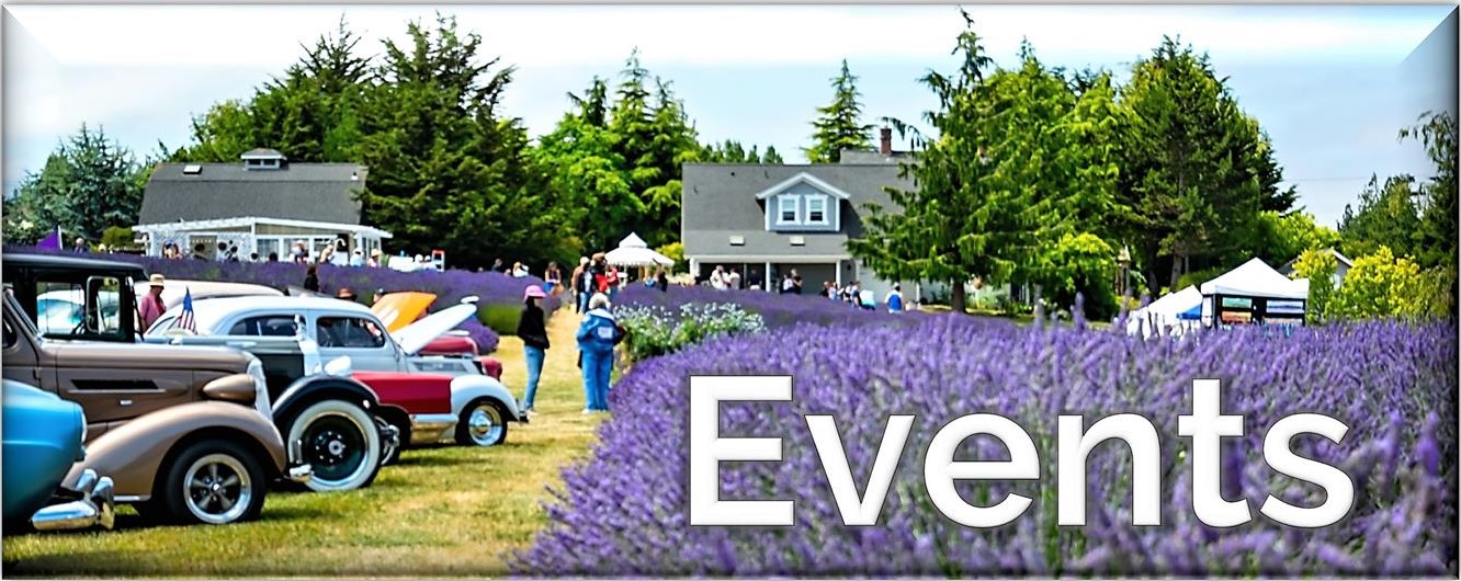
Click for Events, Festivals, Cultural Activities in Port Angeles and The Olympic Peninsula!
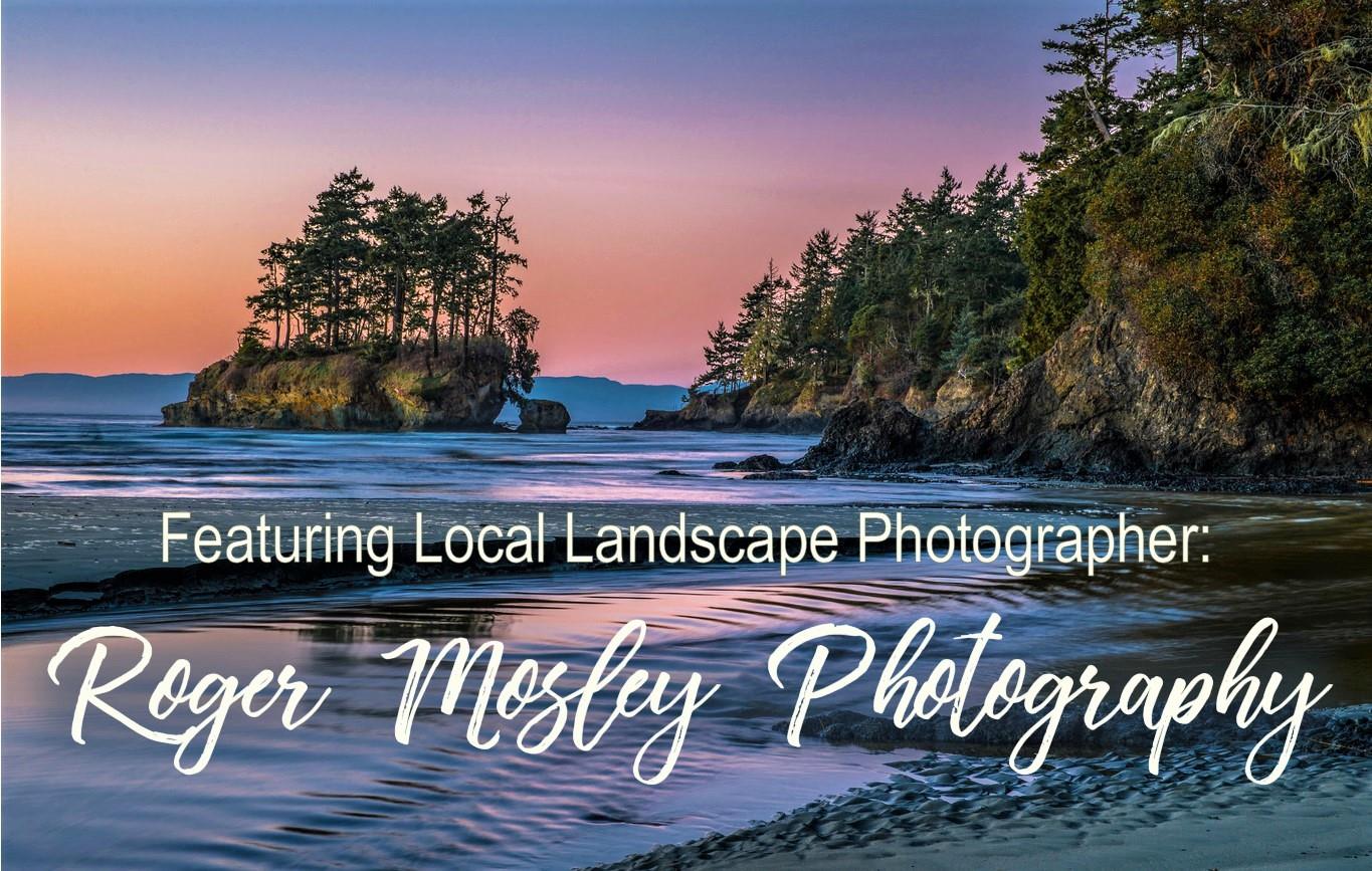
Click the Pic and See the Beautiful Photography of Our Featured Photographic Artist, Roger Mosley.
Enjoy Your Vacation!
Take Beautiful
Olympic Peninsula Travel Guide
With You!
Cristy, from Port Orchard, Wa, Says:
"I wanted you to know that I appreciate your book so much! I have a few books about hikes in the area but your book is unique. I love how you include maps, online resources, restaurants, places to stay, and on and on.
"Plus, your writing is professional yet personal. Our neighbors just moved to Washington and have been trying to explore the local area. I recommended this book to them. They bought it on the spot!
"Thank you for the time and effort you put into making a much needed book. I have lived here most of my life; with your book, I feel like I’m discovering where we live through a new lens. It's simply wonderful" (Cristy, Wa).
Click the pic above for much more info.
Available in Paperback & Kindle from Amazon and Wherever Books Are Sold.
Or, Purchase Your Autographed Paperback Copy Below!
Only $23.35
Click on The Photo Above for More Info, Or
Purchase Below!